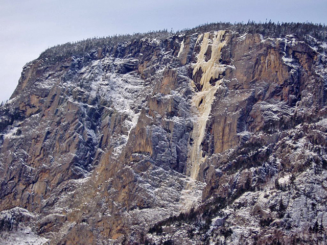
The Wilford Finish

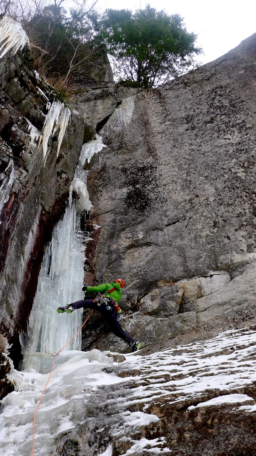
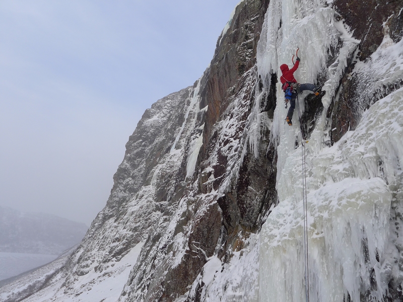
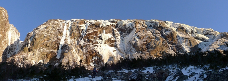
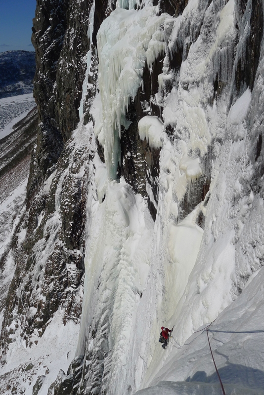
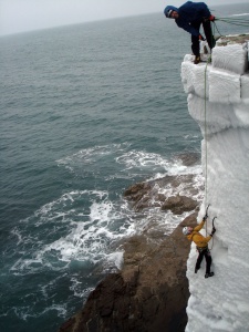
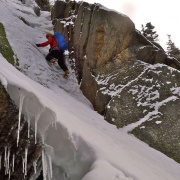
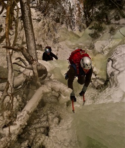
Peter Doucette &  Michael Wejchert refusing to give up winter!

The alarm went off at 5:30 a.m.
“UNNGH!!!!”
Staggering downstairs, I pushed aside empty PBR cans and groped for the french press. The high school themed party (I never thought I’d dress like a guidance counselor before) was a rollicking success. While I wisely stayed away from whiskey and other such temptations, my room, located 15 feet away from the epicenter of revelries, afforded little chance of rest.
Let’s just say the optimism and excitement that usually welcomes in the ice season is gone by March. But with Alaska trips coming up, Peter Doucette and I thought it’d be good to stay sharp. While most friends are clipping bolts in the Red River Gorge and planning for the spring’s rock objectives, I’ve been trying to maintain winter climbing ability.

Read the rest here..

Source: http://www.farnorthclimbing.blogspot.com – Michael Wejchert


Lost and Found

image

Lost:
Sense of humility,  proper assessment of ability. Last seen somewhere between Canmore, AB and the belay atop first pitch of Whitemans Falls.

Lost:
Pair of balls. Last seen between 2nd and 3rd screw, pitch 2.

Lost:
Dignity, pride, ego. Last seen between 3rd and 4th screw, pitch 2.

Beer if returned to owner.

Found:
Abject terror, reality, shame. Found at new v-thread at junction of giant mushroom of doom and scary-hollow pillar.

North Gully, Huntington Ravine 2.22.13


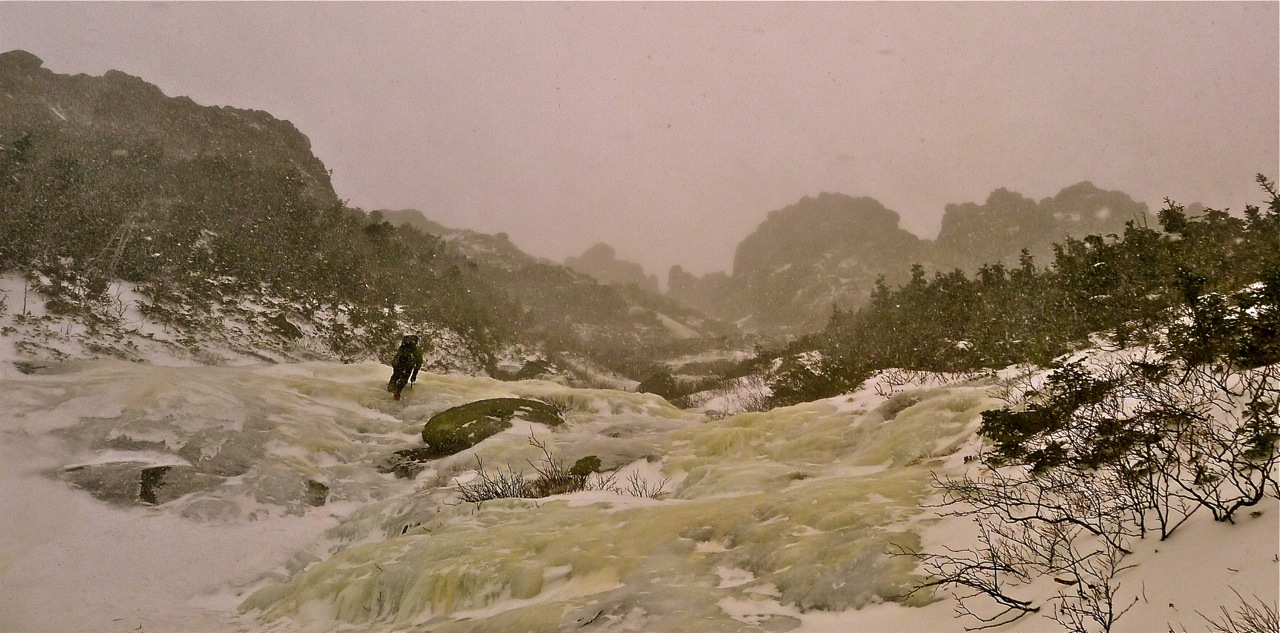
The calm before the storm and another beautiful day in the alpine zone. One week earlier Doug and I enjoyed the “calm” with entirely different conditions in Madison Gulf.  This time we experienced mid March weather on February 22.

Enjoy and get ready for the long days of March.

Alan Cattabriga

Click images to enlarge.

Photos from our day

[nggallery id=31]
Photos by Doug Millen & Alan Cattabriga


Lard Tunderin’ Jaysus, Der’s A Lotta Ice Up Der B’ys!

by Ryan Stefiuk

I buried my face inside my puffy coat as Andre’s snowmobile lurched into motion. The rubber tread beneath us occasionally slipped on the thick black tiles of ice as we sped along the pond. To my right, Alden and Walt were cruising along, closer to the shoreline. The Cholesterol Wall, looming just above them, is bathed in the most wonderful, soft orange evening light. The sky is deep blue overhead, and the air is warm and windless. A few minutes later we’re crossing the community woodlot and nearing the trailhead. The sun, the lone figure in a brilliant cloudless sky, is setting over the ocean to the west. No amount of illicit mind-altering substances could induce the trip I’m having right now.

Alden Pellett on the crux of "Hide the Baloney", WI5+, 550'

Alden Pellett on the crux of “Hide the Baloney”, WI5+, 550′

” To put things in perspective for the average New England climber – take Lake Willoughby and triple it’s height, and then cross it with Cannon Cliff, and you have Ten Mile Pond Cliff “
Alden Pellett and I have just climbed Stratochief, a 700′ WI 5+ on the Cholesterol Wall in Gros Morne National Park along the west coast of Newfoundland. We’d stared at this line during our first day of this trip. On our last day, with good weather, we abandoned our planned objective which we knew we’d climb without much trouble, and charged off into the unknown. This decision was the best one we made during our entire 10-day trip.  450′ of spectacular “spray ice” dripping from the imposing roofs overhead had painted an entire steep face with thin, yet climbable yellow ice. An exposed, rightward traverse across this face led upward, to the crux. From there, secure mixed climbing and WI5+ ice in a corner led to a ledge and the top. We both agreed, as we topped out, that this was one of the most mindbending routes either of us had ever climbed. Combine this with perfect weather, a partner you love to climb with and you have perhaps the best day of climbing you’ll ever have – a day to remember for the rest of your life.

On the Road

Newfoundland is a land of extremes. The drive from New England is long, boring, and almost always includes awful weather while traveling through Nova Scotia. Our 7-hour ferry crossing from Nova Scotia to Newfoundland has been delayed more times than it’s been on schedule. The ferry routinely gets stuck at sea. The “puke fests” that ensue are legendary. One women told us it was so rough during one of her crossings that water was spilling out of every toilet on the boat as it rocked for 18 hours off the coast of Channel-Port aux Basques. They spent days bleaching that boat afterward. The warm ocean currents from the Gulf Stream and the Gulf of St. Lawrence make the weather fickle and windy.  It can snow a foot or two in a day, but if it’s windy there won’t be any snow on the ground, anywhere. It can be -20 degrees for days straight, or it can be 45 degrees for your entire trip. If you’re lucky, you’ll climb 5 days on a 10-day trip. It’s probably better to expect 2-4 days of climbing during that time and if the weather sucks you might not climb at all. Black Horse Lager will be a good friend.

The people are friendly, hospitable and inquisitive. Each oceanside town is small, with only a few hundred year-round residents. None of them are climbers, but many of them are familiar with the fjords and they’re ringers when it comes to driving their Ski-Doos. Finding your way into the fjords can be as easy as saying “hello” at the general store or restaurant and asking if there’s anyone who’s willing to show you the way into the “ponds” (sounds more like “pand” – Newfoundlanders slaughter vowels like nobody’s business).

Ryan Stefiuk preparing for a trip up Stratochief, which climbs the weak groove up the face, before traversing right to a corner system that breaks the giant overhangs above. Photo - Alden Pellett

Ryan Stefiuk preparing for a trip up Stratochief, which climbs the weak groove up the face, before traversing right to a corner system that breaks the giant overhangs above. Photo – Alden Pellett

There are several fjords or “inner ponds” – they’re easy to spot on any topographic map and on Google Earth. I’ve spent hours, maybe days, pouring over maps of the west coast and there’s a lot to look at. Unfortunately, access to nearly all of the fjords is extremely challenging during most winters. The inner ponds don’t freeze regularly in all but one fjord. Fortunately, this pond has the most impressive array of climbs most ice climbers have ever seen. Ten Mile Pond is home to mega-classics like Fat of the Land (WI5+, 950′), Weather Vein (WI5, 1600′), Stratochief (WI5+, 700′), and He Speaks for Rain (WI6, 1000′). Each of these routes is insanely classic and ranks among North America’s finest. To have nearly two dozen of these routes in one place speaks worlds of this venue’s quality. To put things in perspective for the average New England climber – take Lake Willoughby and triple it’s height, and then cross it with Cannon Cliff, and you have Ten Mile Pond Cliff. It is that good.

The C-Wall in morning sunlight. There are about a dozen routes on this face alone.

The C-Wall in morning sunlight. There are about a dozen routes on this face alone.

The crown jewel of Ten Mile Pond is the Cholesterol Wall. The C-Wall, as it’s known by Joe Terravecchia and Casey Shaw, who’ve established most of the routes, is a 300 meters wide, yet houses a dozen classic lines ranging from 500-950′. This wall is backcountry ice cragging at it’s finest. At 8-miles from the nearest road, it’s no place to screw up, and there are no routes easier than WI5+ on this wall, but each route is pure bliss on a nice day. On a heavy weather day it feels like Alaska during a bad storm. During this trip, by the end of one day there was 4 feet of new snow on the ledges. Two cold and windy days later that snow was entirely gone; I don’t know where it went but it wasn’t there.

Alden Pellett traversing across the face of Stratochief

Alden Pellett traversing across the face of Stratochief

Seeing is believing, and I’ve seen enough to be convinced that Newfoundland may be North America’s finest ice venue. So, if you don’t mind a long, heinous drive in bad weather, an even more heinous ferry crossing, really cold windy weather or torrential rain and you can lead WI5  in 5 degree weather miles from roads, people and with no real potential of being rescued you will be rewarded with some of the world’s finest ice climbing. Oh hell, even if you don’t climb super hard there’s a lifetime’s worth of climbing there. The beauty of the place is that there’s no guidebook – you’ll just need to explore like every other climber who’s visited the west coast has done.

Even though some areas in Gros Morne National Park have reasonable access there is no management plan regarding ice climbing there. It’s a privilege to climb there and it should be considered an “alpine” climbing area, like any other mountain region. If you can’t climb your route without bolts, leave it for future generations to climb. Leave the drill at home.


Ryan Stefiuk / NEice Ambassador

Valley Vertical Adventures


Madison Gulf

  Madison Gulf and Mt. Adams

The Eastern aspect of Mt. Adams and the ice of Madison Gulf

The Eastern aspect of Mt. Adams and the ice of Madison Gulf (lower right) Click image to make larger.


The Great Gulf  is a massive area shroud with mystery.  In the early years of hiking for many of us here in the White Mountains, the huge drainage of the West Branch Peabody River, the “Great Gulf Wilderness”  was a place filled with intrigue.  The remote drainage with its many tributaries, gulfs & ravines holds something almost lost to us here in the New Hampshire. And is a place that harbors silence and a true feeling of being alone.  Experiencing this area in summer or winter, total responsibility for one’s actions is paramount.  This is especially true during the winter months.  However, it is during this time when one perceives the rare peacefulness that resides here.  A peacefulness so complete, a single bird singing a short song goes right to the heart.  During all of my time spent out in the winter months, I try to mimic the quiet of this season.  A small and perhaps vain attempt at keeping human noise out no matter where I am.  Often I think to myself, this is what goes on, all the time, when I am not here. I’m just a blip on the screen in this environment and attempt to have my passage go unnoticed.

On the East Face of Mt. Adams, glowering above Madison Gulf resides a cliff.  The ice that hangs in various lengths and hues of psychedelic colours off this wall offer wonderful climbing in a wilderness setting.  At the end of a day your body will be tired and the mind satisfied with all it had seen.  This is especially true if the summit of Adams is reached after the ice climbing is over.  Madison Gulf is a climbing area that will not appeal to everyone.  The approach and descent, the weather, ice and the mountain itself are all ingredients that make this a very satisfying day for those that come here.

I’ve been into the Gulf many times, via both aspects of approach, the East and the West. For the past four years my preferred approach is from the West via the Valley Way Trail in Randolph.  Not only is this way going to be packed to the col, it’s skiable  and lends itself to summit Adams as a finish to the climbing and subsequent descent.  My last time in via the Great Gulf/Madison Gulf Trails in 2009, took 7 hours just to get to the ice. It was a beautifully epic day that opened my eyes to put away the guide book and approach from another direction, one that made sense to me.  Check out the Post  here.

Milage to the ice, with ether choice is close.  However the time may not be. The Western approach, the Valley Way is  ~4.7. The Eastern, Great Gulf/Madison Gulf trails about ~5.3. The key to the approach for the Great Gulf Trail is a lean snow year or early season.  Alternatively, catching the Valley Way tracked to the col. can happen almost anytime.  To each their own, I’ll not say one is better than the other, it all depends on what you seek.  The Valley Way is faster and can have complete solitude, that is if you leave early enough.  It also has the wonderful terrain of the Madison-Adams col. The beauty of Star Lake and passing the craggy Parapet en-route to the descent could be a destination in itself.  The Great Gulf Trail feels remote after the first bridge. The river sings almost throughout the entire hike and you’ll pass through some of the states most beautiful forest and countryside.


Saturday, February 16, 2013

The day after an excellent session of lift service skiing, Doug and I are on the Valley Way Trail.  In a few hours we are at the Madison-Adams col.  The fog and stillness join together to create an eerie, though appealing environment.  Our view of the ice from the Parapet is not available for fog is dropping like a heavy veil over the mountains face.

I kept the descent on the high side, not wanting to get drawn too low. And though the visibility and snow conditions were less then perfect, in little time we came to the northern most route, Point du Pinceau.  A traverse along the base brought us to our destination. The line of Point is the longest on the cliff.  This is the best route to do if one is not rappelling and continuing on by ether traversing off via the Buttress Trail back to the col or upward to the summit of Adams, Point gets you closer to both of these two exits.

The ice is perfect. The large flow was a cascade of movement caught and frozen in a kaleidoscope of colours.  We climbed side by side until a headwall of steeper ice at one third height. Here we climbed through a weakness one at a time.  Above, the ice was like an azure sea with islands of white sand. It flowed upwards,  lapping like the tide  into a green mainland of stunted trees.

The snow through the trees was airy and deep, snowshoes were once again required.  After crossing the Buttress trail which runs from Star Lake down into the Great Gulf, we continued up an unseen mountain looming above. Part way to the summit the snow became firm and the rime iced rocks more exposed.  We stopped in the surreal landscape, packed the snowshoes and took a tea break.  The fog was thick and the wind light and we took the wonderful atmosphere into our souls.

The summit came to us like the face of a wraith out of the fog and after a quick handshake we were off.  The Airline Trail drops off the top and after a half-mile merges with the Gulfside Trail.  We followed this back to the col and flowed like liquid back down the Valley Way.

Reanimating areas and climbs is my passion.  I look at Madison Gulf as a challenging way to summit Mt. Adams.  The unusual weather we had, the constant changing of ice and conditions made this another wonderful experience.  Grades did not matter and without any expectations of what lay before us, this was about experiencing an amazing area and climbing a mountain, pure and simple.

Another great link-up  when the snow is just right is that of King Ravine to Madison Gulf. Here is the link to a post from 2009.  Link

Thanks to all for taking the time to read this. And thank you to Doug for being there.


Alan Cattabriga

Photos from the Climb

[nggallery id=30]

Photos, Doug Millen and Alan Cattabriga

Spray Ice!

Otter Cliffs
Acadia National Park, ME

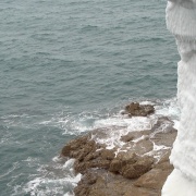
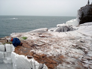
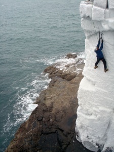
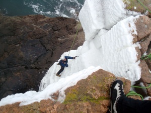
Well you don’t have to travel to Helmcken Falls, Canada to climb “Spray Ice”. You just need the right weather and timing.

Report from Josh Hurst

“Ian and Owen found found some spray ice after the blizzard on Otter Cliffs in Acadia National Park, ME and gave me a call at lunch to join them.  I don’t think I’ve ever had so much fun climbing ice!  If it gets cold the ice should hang in there but it was very soft and falling apart today”

Here are some photos of the climbing (click to enlarge)

Acadia national park - Spray Ice 1


Acadia national park - Spray Ice 2


Acadia national park - Spray Ice 3


Acadia national park - Spray Ice 4

High and Dry, Mt. Lincoln NH

“High And Dry” ( erroneously named Woodman/Dorcy in my post Spirit, the names of the FA team) is an excellent introduction to the wonderful climbing in Franconia Ridge back country.  The approach up the Dry River is straight froward and easy. Depending on conditions of course. One starts this adventure by parking at the Old Bridle Path/ Falling Waters Trailhead, the same parking lot for Lincoln’s Throat.

In a short distance (.2m) turn right on to the Falling Waters trail. Hike this trail for ~ 1.5 miles until the last brook crossing ( L to R side) and then follow the Dry Brook directly to the base of the slide. The finish of this climb is on the Franconia Ridge just south of Lincoln’s summit, where it gets craggy at the little detached tower. This section of ridge is one of the most aesthetic in the state.

Friday 2.8.13 , on the toes of the oncoming snowstorm, Ted Hammond and I got into this beautiful drainage and slide before it turned into a expert BC ski run. What applies to some bc climbs applies here, High & Dry is best done early season or during a lean snow year.

Of note, this is also a great summer hike. With the climbing on the slabs in the 5.4 range, and many finishing options on the cliffs guarding the Franconia Ridge.

Below is a slideshow of our day, enjoy.

Cheers,

~Alan Cattabriga

[nggallery id=29]

Seeking Repentance

“What the fuck do I do here?”

I don’t know who I’m talking to… it’s just me and the huge chockstone looming above. Doubt is creeping in, but it’s kind of a moot point. I’m committed. The ice below the chockstone is ok, but it isn’t really of the quality that I’d be psyched to set a thread. Besides, this is what I signed up for. You don’t head up Repentance just to bail below the signature moves.  This climb was four years in the making, and there was no way I wasn’t going to finish it.

*****

Repentance first captured my imagination four years ago. At that point I was just starting to climb harder lines, and it was in FAT. I worked my ass of to find a partner, but with no luck. Drew was interested but was stuck in Burlington without a car. For years I kicked myself for not driving out to pick him up…

*****

The first pitch is just engaging enough to make me wonder what I’m getting into. Linking pitches one and two is DEFINITELY out of the question… It seemed like a good idea last night. But as Don Mellor once told me, belaying is just part of the experience. It’s beautiful out, I might as well enjoy the break, and maybe I’ll come up with a reason to rap down and go home.
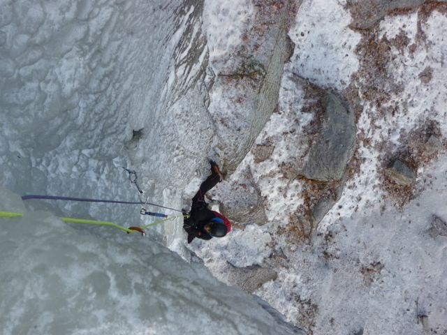
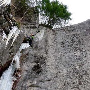
Pat W. does his Poseur impression following P1

I place a screw in the column pouring out of the chimney above while Pat W. flies up the first pitch like it’s a WI2. Seriously, is this the same guy who was taking forever following 4s earlier this season? Fuck, now I’m the slow one. The screw is shit, but it’s better than factor-2ing my anchor… I think?

I was in the same place just over a year ago. Matt was gracious enough to tag along with me as I stroked my ego, delusions of hardman-status dancing in my mind. More importantly, he was gracious enough not to judge me as I backed out of the pillar just below the roof – delusions of grandeur and ego so rudely checked.

A few weeks later I was back at Cathedral with Chris. We got scooped though by Erik E. on one of his dawn patrols. We opted for Remission instead. I probably took over an hour on the first pitch, but the second went quickly. Chris was clearly not psyched by the pillar above but I wanted to at least check it out. I climbed right up to the steep stuff in the pillar, but decided perhaps it wasn’t the right day to do it, and down-climbed back to the belay. We rapped down, but Repentance was free… we passed that day, and again I kicked myself.

*****

My right foot is in the column, and my left finds good features on the rock wall to my left. The screw I placed while at the first belay is absolute junk, but I place a second, which inspires at least a little bit more confidence. Before I know it, I’m no longer stemming across the void and have both feet on the front of the column, ice tools above the narrow choke-point from which the column pours – “holy shit, I’m actually through this” I think.
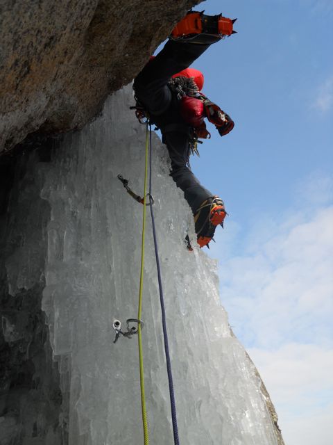
One crap screw, one good screw, and great feet.

“This is going to be hard the whole way!” I call down to Pat W. And it is. There’s plenty of ice in the chimney above for some good sticks, but this isn’t the straight-forward, classic A-technique climbing of the Lake. This is full-on dry-humping my way up the chimney. First it’s one hip in, then the other, then both are squeezed in (good thing I’m not a MOG). Then it’s back to one hip in.

Swing, awkwardly grope the rock and grind on it like a 14 year-old boy with a busty blonde, repeat…

The chimney seems to go on forever. Just when I think it might get easier and more straight forward, I’m getting intimate with some of Cathedral’s finest once again. “Hey Pat, you should just put your belay jacket in the pack and throw it down to the base, you definitely don’t want to bring it up!”

Eventually, I reach the first fixed anchor atop the pitch. I’d really like to go to the second, but I’ve used up all my slings (actually, I didn’t… I had plenty more, but they were hidden behind the rock rack… dumbass). I build the belay and bring Pat W. up to me.

*****

Pitch 3 is the antithesis of pitch two. The ice is straight forward, though fully running with water on the right side. My arm is soaked, but the swings are hero-sticks for a good portion of the way.
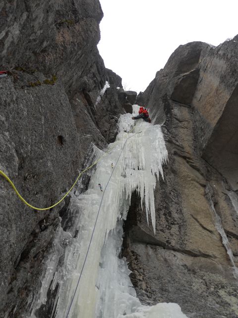
Soft, wet, runny ice on pitch three. The chockstone looms above

 *****

The ice seems to be leading me to the right side of the chockstone, but I know I can get a #3 in the left side to protect the exit. I look at the right, and decide “fuck it”… I’m going for the left.

Work up under the chock stone… damn that roof is big…

Throw in the #3… it’s a bit of a blind placement, I hope it isn’t in an icy part of the crack.

Leave the tools in the ice below, undercling the chockstone, backstep my left foot on the divot in the rock wall. Throw in the fist jam, reach WAAAAAY under the stone to grab a tool, cam it in the crack, reach even further under to grab the other tool, hook a crappy little divot at the top of the crack. Stem right, move my foot up left, lay back on the cammed tool, throw my left foot way out on the arete… Swing up above the divot… nope, rock. “Fuck!” I really hope I don’t whip onto the blindly placed #3 below the chockstone… I think the screws just below it are good enough…

Turf shot out left… turf shot up above and right… And like that, it’s all over.

*****

Repentance is the best route I’ve climbed. Period. It’s hard, it’s fun, and offers some unique climbing experiences in a beautiful setting. I can’t believe I was even thinking of leading it four years ago… there’s no way I was ready. I’m not kicking myself over blown opportunities any more. This was the perfect time to finally climb a long-sought after classic.

A Fool’s Paradise

It’s the ice fest weekend. During this event many think every route in the White Mountains will be crowded. This is not the case, that is if you know what to do and when. The rains came just 24 hours before the official start to the fest, and once again many were lamenting.

Shoestring Gully

However, with the impending invasion of low temperatures, my friends and I saw the opportune time open up for many routes.

The Canadian air arrived Thursday night, with Friday dawning sunny and cold. We decided on Mt. Willard, totally alone excellent ice was found.  Knowing Saturday would be busy we went for the dawn patrol mission of Shoestring Gully on Mt. Webster. The cold was doing it’s work on the mountain.

Upper Hitchcock

The ice on Mt. Webster was in fine shape. Now it was Sunday and time for something long, adventurous and completely new. Starting at the same spot as Central Couloir and taking off left, the line of Fools Paradise fit perfectly. Enjoy the slideshow below of this wonderful route. Suffice it is to say, the start is rarely in, but it is now.

Cheers!


~Alan Cattabriga


Photos from  ” A Fools Paradise” 02/03/2013

Mt. Webster, Crawford Notch NH

[ngg_images source=”galleries” container_ids=”28″ display_type=”photocrati-nextgen_basic_thumbnails” override_thumbnail_settings=”0″ thumbnail_width=”240″ thumbnail_height=”160″ thumbnail_crop=”1″ images_per_page=”20″ number_of_columns=”0″ ajax_pagination=”0″ show_all_in_lightbox=”0″ use_imagebrowser_effect=”0″ show_slideshow_link=”1″ slideshow_link_text=”[Show slideshow]” order_by=”sortorder” order_direction=”ASC” returns=”included” maximum_entity_count=”500″]

 Photos by Alan Cattabriga & Doug Millen


New rules to access La Pomme d’Or

La Pomme d"Or - Fred Maltais

La Pomme d”Or – Fred Maltais

La Pomme d’Or

Every winter, skilled climbers take on the Pomme d’Or, a spectacular and perilous rock face along Rivière Malbaie. For permission to climb this ice wall in the park, you’ll need an access permit. Refer to Reservation Terms and Conditions for all the details.

Climbers must be in excellent physical condition and totally independent, since the ice wall is about 30 km from the closest telephone and off the park’s network of roads and trails. Under good weather conditions, it takes a full day of snowshoeing or off-trail skiing to reach the site.

If you are independent, climbing the Pomme d’Or requires a minimum stay of 3 days in the park.

  • Day 1: 30 km of snowshoeing or off-trail skiing to get to the foot of the cliff;
  • Day 2: climb the ice wall and return to base camp;
  • Day 3: 30 km of snowshoeing or off-trail skiing to return to your car.

We strongly recommend bringing a satellite telephone or a SPOT-type emergency message device. There is no emergency telephone on the site in the winter and the cell phone network does not serve the park’s territory.

http://www.sepaq.com/pq/hgo/index.dot?language_id=1


Location

La Pommed D’or is located approximately 2.5 hours east of Quebect City. The nearest decent sized town is Malbaie, Quebec. You enter the Parc de Haute Gorges I believe and drive as far as they will allow, before you begin your ski approach.

Administrative Guidelines and Obtaining a Backcountry Access Permit

It is mandatory to hold an Access Permit to climb the Pomme d’Or. To get one, you must apply in writing by filling out the appropriate form.

Applying for a Pomme d’Or Access Permit for Stays of More Than One Day

Once your itinerary is ready, you understand the associated risks and you consider yourself ready to assume them, you must fill out the Backcountry Access Permit Application form. Each member of the group must individually fill out the form. However, all applications for the same expedition must be sent in one mailing to the administrative office of the Parc national des Hautes-Gorges-de-la-Rivière-Malbaie.

Each application is analysed to make sure that the expedition respects instructions related to the mission of the national parks and that it will take place in the targeted sector. If your application is in order and the reception capacity has not been reached, a confirmation will be sent.

Allow for a 7-days waiting period from the time we receive your Pomme d’Or Access Permit Application. The cost is $10 /pers./night (maximum 8 nights), in addition to the park entry fee. These fees must be paid in full by credit card or cheque prior to your stay.

Modifications

If you wish to modify the stay dates or replace members of your team, you must do so at least 72 hours prior to arrival by directly contacting the administrative office of the park concerned.

Cancellation

If you want to cancel your stay, you must do so at least 72 hours prior to arrival by directly contacting the administrative office of the park concerned. No refunds will be granted for a cancellation made less than 72 hours prior to arrival.

Contact Information for the Administrative Office

Your Safety, Your Responsibility

Before submitting an application for authorization to climb the Pomme d’Or, you must be aware that help is far away and that your safety is your responsibility. Adequate preparation is required. First ask yourself if you have the skills, abilities and fitness level to undertake this kind of expedition. Climbing the Pomme d’Or involves certain risks, and it’s important to know what they are so you can prepare for them and be ready to react appropriately.

We invite you to consult our tip sheets about activities and stays offered by Société des établissements de plein air du Québec (Sépaq). The Fédération québécoise de la montagne et de l’escalade can help you plan your stay and your activities safely. Don’t hesitate to contact them.

No patrols are made at this time of year in this part of the territory. Emergency services are far away and access to the Pomme d’Or is particularly difficult. For incidents requiring immediate care or evacuation, wait time can be very long (sometimes several days). The isolation of this sector means that there is no cell phone service. A first aid kit and knowledge of how to apply first aid in remote areas are essential in emergency situations.

Costs related to search and rescue operations are solely the responsibility of the recipient. We strongly recommend checking whether or not your insurance company covers these costs. Otherwise, some private companies, such as Airmédic, offer the possibility of benefiting from such services by becoming a member of their organization.

No verifications will be made as to your return. It is your responsibility to give someone you trust a copy of your itinerary, making sure to indicate the date and times of your return and instructing the person to contact emergency services (911) in the event of your absence.

In Harmony with Nature

Minimizing our impact on the natural environment is a duty. The behavior you adopt during your stay at the park must constantly be guided by the desire to preserve the integrity of nature and our surroundings so that other climbers can fully enjoy the same privilege.

Parcs Québec considers the application of Leave no trace principles as the reference for behaviours in the national parks.

Number of People in the Group

For safety reasons, it is recommended to go in groups of a minimum of 3 people. To minimize disturbance and impacts on the natural environment.

Campfires

It is prohibited to make fires in the back country. Bring a camp stove for cooking.

– Source: PARCS QUÉBEC / PARC NATIONAL DES HAUTES-GORGES-DE-LA-RIVIÈRE-MALBAIE